
Amanda Abrams is a writer based in Durham, North Carolina.
Photography by Chris Facey for Noema Magazine.
ALLIGATOR, N.C. — The water has always been here. Bounded by giant estuaries, cut through by rivers and creeks, the peninsula poking out toward the state’s barrier islands was originally covered by sprawling wetlands known as the Great Alligator Swamp, a patchwork of pocosin, peatland, hardwood forest and saltwater marsh. Over millions of years, deep deposits of organic matter built up and fed the growth of dense shrubs and foliage — pond pines, loblolly-bay, whitewicky, staggerbush, sedge, winterberry and much else.
Initially the heat and mud and brambles and biting insects repelled settlers from the north, who hovered on their boats around the fringes and left the interior to its native inhabitants, tribes like the Secotan and Tuscarora. But the newcomers slowly made incursions, using the waterways as highways. Eventually they got into the heart of the peninsula, where they dug canals to drain the swamps and access distant corners of fertile black soil. They cut and sold the trees and planted cotton, corn and potatoes. And they settled down, built homes and communities, established a shared history.


“There used to be families living here, houses. There’d be people grilling, kids swimming,” Glenn Bailey tells me. “There’s much more land under water now.”
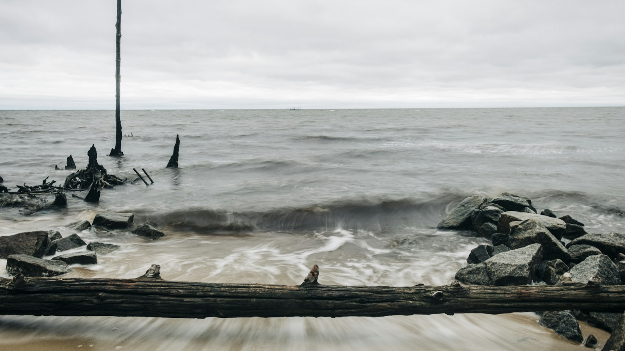
Robert Thompson nods. “We lose six feet of shoreline every year.”
Bailey and Thompson and I are standing on a small beach looking out on the Albemarle Sound, talking about flooding. Some locals say the water in this spot used to be about 80 feet farther out; some say a quarter mile. Now, there’s about 15 feet of sand between the end of the road and the beginning of the waves.
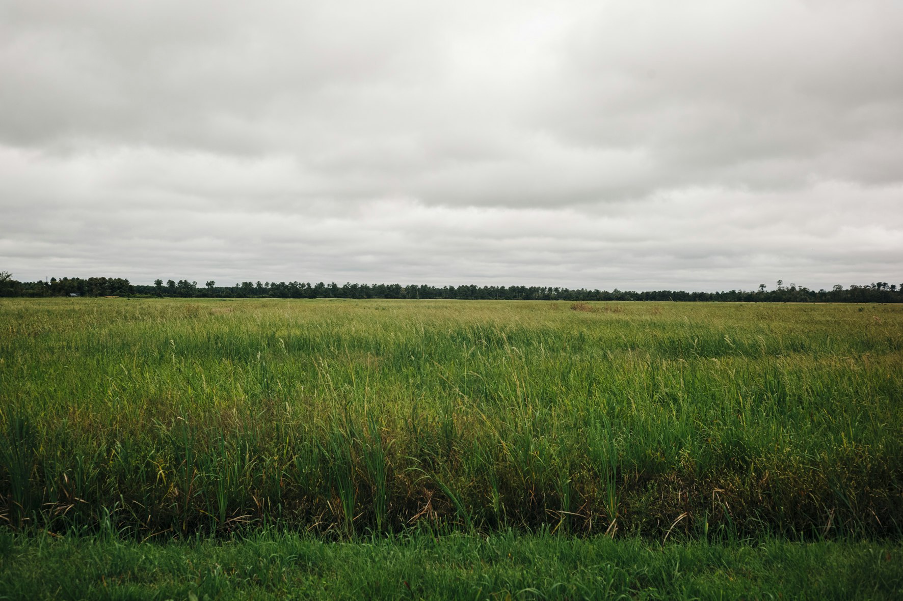
This is Tyrrell County, North Carolina, some 30 minutes inland and a whole world away from the state’s storied Outer Banks. Half the county is publicly owned land and much of that is wilderness, home to bears, migrating tundra swans and a few red wolves. Elsewhere, what was once impenetrable undergrowth has been transformed into vast fields of corn and soybeans that thrive in exceptional soil. The county is the state’s least populous — it has only one official town, Columbia, and a smattering of smaller hamlets like Alligator — and also one of its poorest.
If the county is thinly populated, remote and poor, Alligator is those things to an extreme. Founded before the Civil War, the township has been so isolated for so long that some people who live here speak with a “Hoi Toider” accent that originated with English settlers in the 1600s. Still, not long ago, it was lively — people both white and Black farmed and fished and sent their kids out to roam. It’s mostly Black now, and it’s dwindling: only around 250 inhabitants. The median household income is around $31,000, about half the state average.
Bailey is an Alligator native, Thompson a county commissioner. I asked them to describe how the flooding is getting worse. The yards are so wet that gardens can’t thrive, they said. One of the local cemeteries is periodically under several feet of water. Bailey’s own land gets inundated for months at a time. “I had to put waders on to get back there to my hog pen,” he says. “It was knee deep.” Congregants put on rubber boots to get into the local Baptist church on Sundays.
“No one denies that the weather is changing. No one can. But people have their own explanations.”
Water is encroaching on the entire peninsula from all directions. Groundwater is higher, shorelines are closer and swamps and ditches are frequently brimming. Rainstorms have become so intense that even farmers with pumps struggle to get the water out before it harms their crops. The effects of rising water don’t end there. As it moves inland, saltwater kills trees and creates vast “ghost forests,” a phenomenon researchers originally discovered on the eastern edge of the peninsula.
Those changes are invariably more extreme in Alligator, where residents are never far from a river, creek or the sound; the land is barely a foot above sea level.
To scientists, none of this is surprising. Tyrrell was identified in a 2016 study in the journal Nature Climate Change as the U.S. county most at risk from climate change, with 94% of the population living in areas likely to flood. And Alligator was labeled one of the most at-risk communities in the county. Other research has shown that much of the county’s land will be underwater by 2050, including all of Alligator.
But virtually no one living in this very conservative county admits to believing in climate change. Utter the words and folks might recoil as if you’ve said something taboo. Their reasons differ: Climate change is a myth, some say, a tool that politicians use to further their own agenda, a heresy that runs counter to God’s plan for humankind. Others point out that the effects are inconsistent: Why are some sections of the coastline flooding more than others?
No one denies that the weather is changing. No one can. But people have their own explanations. Farmers say it’s cyclical, that the current phase is an echo of the heat and drought of the 1930s, and they just need to manage it. Others say the sound is clogged up and water can’t easily get through inlets into the open ocean, leading to a rising coastline and more water in the swamps.
The most popular reason, the one I hear repeatedly from almost everyone I speak with, is the ditches.


“Ditches” makes them sound small and trifling, but they are what created this place. Early settlers dug troughs in the ground and water flowed into them from the swamps, and then into bigger ones and eventually back into a river or straight into the sound. Ditches are what dried the land out. Mostly it was enslaved people who dug the first ones, and historians say it was horrible work: hot and mucky and rife with snakes.
The early ditches are still here, hundreds of years old. Some are 30 feet or more across and a dozen feet deep. Canals would be a more appropriate term for them. I felt like I was in northern Europe when I first saw them.
Now many crisscross the county, and they line all the roads, but they aren’t being maintained. Everyone swears that the local department of transportation office used to regularly dig them out so they flowed well. Not anymore.
“All these ditches in Alligator is plugged up and need to be cleaned out,” says Colon Bailey, Glenn’s older brother. Colon owns Tyrrell County’s last country store, in a county that once had dozens of them; residents from across the area pass through for a barbeque sandwich, a bottle of beer, a game of foosball. Water from the ditch across the road will wash into the store after a particularly big rain.
“These days, the ditches are choked with weeds and silt. ‘A dog could walk over them,’ locals like to say.”
“I’ve been here all my life, and it’s never been like this,” Colon says. He and Glenn and others remember a time when they could travel for miles along the ditches by boat, fishing herring straight out of them. These days, they’re choked with weeds and silt. “A dog could walk over them,” locals like to say.
If the ditches aren’t draining, yards and swamps aren’t either. The county is full of clogged ditches, radiating out from Columbia. Farmers complain that they do their best to maintain their own ditches and pump water off their land, but because the wider network is clogged, it all backs up.
That’s why many folks here point their fingers at the DOT for abandoning a task it used to regularly perform. DOT representatives told me their responsibility ends with keeping the roads clear of water, and they no longer have the funding to do more.
According to Tyrrell County’s soil and water conservation district manager, the local government doesn’t have the authority to clean most of the ditches. And even if it did, the county commission chair, Nathan Everett, says it doesn’t have the money. Currently, there’s a moratorium on cleaning them out in Alligator, in fact, pending a hydrology study — which the county can’t afford, so it probably won’t undertake it. No wonder people feel stuck with full ditches and flooded yards.
Alligator residents never mention race as a reason for this disregard. Nor their comparative poverty. Perhaps the area is simply too wet to be worth the work.


There’s another thing that keeps coming up when locals talk about the water: public land. Fifty-three percent of Tyrrell County is publicly owned. Some of the biggest parcels belong to the U.S. Fish and Wildlife Service and the N.C. Wildlife Resources Commission, but at various times The Nature Conservancy, the N.C. DOT, The Conservation Fund and other groups have also owned land here. According to Commissioner Everett, that acreage has been gradually increasing.
To an outsider like me, land conservation seems impressive and important. This is a wild place, majestic in its own way, with bald cypress, wild orchids and pitcher plants, blackwater rivers, and a sizable population of black bears. Some of the nation’s last pocosins are here: ancient wetlands with dense underbrush and evergreen trees and deep peat soils that take thousands of years to accumulate. Undisturbed, they absorb water and buffer the effects of flooding. And they hold vast stores of carbon.
Tyrrell County people are proud of their land, but few of them appreciate the conservation work. Government agencies don’t pay taxes on the properties they own, so they take land away without giving much in return to a poor region that desperately needs tax revenue. And the land managers generally don’t consult residents when they make plans — some of which, locals told me, directly contradict their own objectives.
In the western part of the county, for example, the U.S. Fish and Wildlife Service maintains the Pocosin Lakes National Wildlife Refuge: 110,000 acres of wetlands that were once fields and are still laced with a network of ditches. The ditches, of course, dry out the pocosins, which releases the carbon stored in the peat into the atmosphere and leaves them vulnerable to fires that can burn for months underground. So refuge managers try to keep the water level high in their ditches, to keep the soil as wet as possible and restore the pocosins.
You can see the problem. Everything is connected. Neighboring properties stay wet too. After big rainstorms, water spills out everywhere.
“Locals are suspicious. They think the whole area is intended to be a refuge someday, devoid of farms and people and churches and county stores, ditches full of water.”
Doug Maxwell farms land near the refuge. “They’ve blocked up the canals,” he tells me. “They’re trying to hold water in the refuge.” Floods coming down from there ruin his crops, he says. “They don’t understand water.” He’s not the only one who tells me this. “They don’t care about us. All they care about is what they’re doing.”
In Alligator, the state Wildlife Resources Commission owns a large tract of land that’s more or less a swamp; it surrounds part of the community. The once-flourishing farms there have disappeared. Without expensive pumps, it’s impossible to dry the land enough to grow crops.
“There’s competing interests over a historic canal system,” says the county manager, David Clegg, who used to work for the state in Raleigh. The failing canal system that locals and farmers sorely need, he tells me, is in apparent opposition to what the state wants.
Debbie Crane of The Nature Conservancy, which has helped with some of the region’s wetland restoration projects, argues that residents will ultimately benefit from their initiatives. “If you can keep that peat healthier, it will give those frontline communities a chance to be more resilient in the face of climate change,” she tells me.
Unsurprisingly, the residents I talked to didn’t see it that way. They’re suspicious. They think the whole area is intended to be a refuge someday, devoid of farms and people and churches and county stores, ditches full of water. “They’re trying to push us out,” Glenn Bailey tells me. Colon agrees. “Best I understand, they’re trying to flood this place to turn it into duck impoundments,” he says. “That’s the word.”


Before I came out to Tyrrell, when I was just reading about the area’s challenges — its extreme vulnerability to sea level rise, the small population and struggling economy — it seemed clear to me that the solution was to relocate residents and give the land back to the water, to turn it into a swamp.
That was before I met the people who live on what land remains, before I heard the stories and histories and understood what it means to be connected to this place. Of course people can’t just be uprooted, not from where their ancestors lived for generations and now rest under headstones scattered throughout the woods.
Tyrrell residents may not believe in climate change, not yet anyway, but they understand the way things are moving. Local and state governments’ inattention to the ditches, so vital to residents’ existence, is a clear message. So is the slow process of buying up and conserving land with a single-minded focus on wetland restoration.
What makes it worse is that no one with authority has reached out to people here in any coordinated way — to talk about the flooding, to tell them what they know and prepare them for what’s to come. The peninsula is crawling with scientists monitoring the water and soil. Even they admit outreach is lacking.
“Soon, the ditches will become conduits for water to come in.”
Amanda Martin, North Carolina’s chief resilience officer, tells me that she wants to avoid forcing a sustainability plan on locals. “Communities want to determine their own futures,” she says. But there’s a difference between imposing a plan and communicating facts essential to survival. Especially if in the future, whether by design or not, this land is underwater.
Without a clear picture of what’s coming, Tyrrell County residents cling to what’s been successful for them in the past: the ditches. They won’t work for much longer.
“The hydrology of the past isn’t what we have today,” says Reide Corbett, the director of the Coastal Studies Institute at East Carolina University. “You just don’t have the gradients you had in the past.” The sea level, in other words, is higher than it once was — it rose about a foot in the past century and is expected to go up another foot or so in the next three. Soon, the land will be too low relative to the sound for water to flow out through the ditches. Soon, the ditches will become conduits for water to come in.
Right now, though, people have some hope. Saltwater intrusion is limited. Commissioner Thompson has become a real ally and advocate for Alligator, recently opening floodgates along the main ditches to get water flowing, loaning out his backhoe so people could clear blockages around their homes. A few residents are speaking out more, pushing for investment in sewers, eyeing a run for county commissioner in November. The past couple of years have been relatively dry and stormwater has been manageable. People like to think the future might not be too dissimilar from the past.


